Floating the Upper Colorado River in Colorado
My notes and research on floating the Colorado part of the Upper Colorado River
Intro
I love floating rivers. I want to someday float the Colorado River. This is where I’m going to keep my notes.
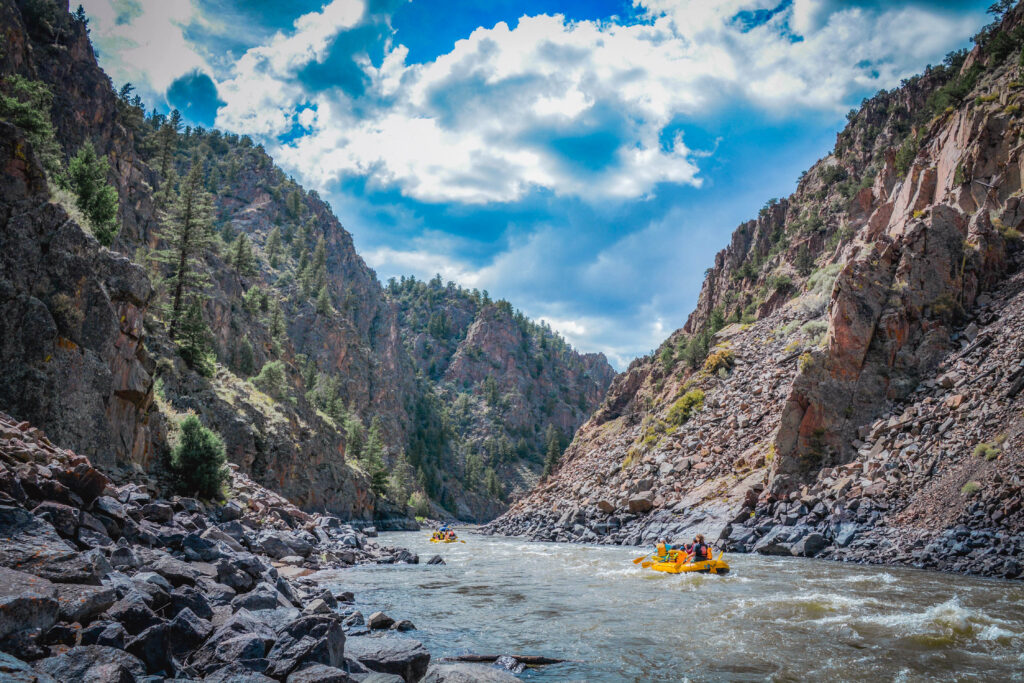
Floating the Upper Colorado River
The “Upper Colorado River Basin” is defined by the river network above Lee’s Ferry in northern Arizona (Grand Canyon) (Source). This post will cover floating from Kremmling, CO to Dotsero, CO. This area is about 1hr northwest of Vail, 2.5hr west of Denver.
Map
- Blue = Put Ins / Pull Outs
- Red = Rapids
- Yellow = POI (Point of Interest) / Information
- Purple = Campsites
Note that there are very likely dispersed campsites that I missed. Some of the launch (put in / pull out) locations have camping too.
To turn the map into satellite, click the top left button to “show the sidebar”, then scroll down to the bottom in the sidebar, then click the satellite-looking image in the bottom left.
Map Sources
I basically took all the information from the below links and fused them into one map:
- Great brochure on floating the Upper Colorado River
- Includes a map and a small paragraph for each section. Judging from the link URL, I think it’s from 2005.
- PDF with labels on each boat ramp, campground, and rapid
- Judging from the URL, I think it’s from 2019.
- BLM (bureau of land management) interactive fullscreen map of the Upper Colorado River Recreation Area
- Includes markings for launch sites, camping, rapids, hiking, parking, and restrooms. Yellow shaded region is BLM land, otherwise the land is private. I imagine this is constantly updated.
- Awesome, modern, interactive brochure
Table
Notes on Sections
Additional information not easily represented in the map or table:
- Parshall to Blue River / Kremmling
- Can’t find much information online about this section. Probably because no one puts in here to avoid going through Gore Canyon. Looks calm?
- Blue River / Kremmling to Pumphouse (BLM)
- Gore Canyon, considered “the most intense rafting in the state” and possibly the United States!
- One section of the river drops at 68ft/mile
- Class IV and V whitewater, experts only, definitely not suitable for floating
- Gore Canyon, considered “the most intense rafting in the state” and possibly the United States!
- Pumphouse (BLM) to Radium Campground (BLM)
- Heavily used
- Pumphouse parking is $5 (2015) which includes parking for the day, camping, and launch fees. Covers take out at everything except Rancho del Rio. Source
- This will take you through Little Gore Canyon
- Small warm spring further below the rapid on the left bank at the foot of the cliffs. Watch out for poison ivy on the banks and around the rocks.
- Warm spring can get crowded. Cliff jumping can attract characters.
- Radium Campground (BLM) to Rancho del Rio (private)
- Looks like large sections of the river here are not close to a road.
- Rancho del Rio (private) to State Bridge
- Separate fees for launching or taking out from Rancho del Rio
- Contact the BLM Kremmling Field Office for questions about the river between Pumphouse and State Bridge
- Some campsites may be close to railroad tracks
- State Bridge to Two Bridges
- State Bridge can get very busy
- Theater here with live music all summer long
- If river is over 5500cfs, the second bridge cannot be floated under. Emergency take-out is on the right between the two bridges.
- Two Bridges to Catamount Bridge
- “The McCoy Waterwheel is the largest waterwheel in Colorado”, built in 1922. Source, pg. 19
- Catamount Bridge to Pinball
- Pinball to Horse Creek
- If the river is above 5500cfs, the water might be too high to go underneath twin bridges / Red Dirt bridge.
- Horse Creek to Cottonwood Island
- Cottonwood Island to Lyons Gulch
- Lyons Gulch to Dotsero Landing
- Contact the BLM Colorado River Valley Field Office for questions between State Bridge and Dotsero
- Dotsero Landing to Bair Ranch
- Blair Ranch is the furthest downstream take out before entering the Glenwood Canyon runs. If you continue further down, you’ll hit Hanging Lake dam.
- “You can find several undeveloped warm springs near RM 71”
Flow Rates
- Flow rate recommendations (source):
- The Upper Colorado is almost never too low to float
- May and June could be too high
- May - September is best
- 300 - 800cfs = mellow float, Radium to Dotsero are all good
- 800 - 1500cfs = potentially exciting float, Lyons Gulch to Dotsero is best
- 1500cfs - 5000cfs = exciting float, Lyons Gulch to Dotsero is best
- >5000cfs = not recommended to float except for Dotsero to Blair Ranch
- The Upper Colorado is almost never too low to float
- FLow rate at Kremmling, start of the float. Flow rate at Dotsero, end of the float.
- If you go down to the “Continuous data” box (maroon), you can also graph water temperature (click “Graph it”), among other things.
Additional Information
- A permit is not required to float the Upper Colorado River. Source. Another source.
- I haven’t found concrete information on if a PFD (personal flotation device) is legally required.
Basic Supplies
- PFD
- Spare oar/paddle
- First aid kit
- Repair kit (duct tape) and air pump
- Throw/rescue line
- Bailing bucket
- Food
- Sunscreen
- Sunglasses
- Insect repellant
- Hat, extra shoes, dry clothes
- Waterproof bags or containers
Sources
- See Map Sources for the sources I used to create the map
- riverbent.com = pretty detailed information on the whole float. Great starting point for research.
- eagleoutside.com = small details on Cottonwood to Dotsero.
- uncovercolorado.com = high level info on the whole float.
- coloradorivercenter.com = detailed paragraphs for each floating section.
- BLM website with interactive map that shows rapids, hiking, and camping locations! Full screen map
- Decent interactive map here showing the different float sections of the river.